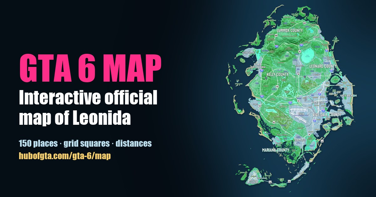
How Big Is the GTA 6 Map? We Measured the Official Map of Leonida
Hub of GTA Editorial Team
Editorial · Hub of GTA
Confirmed official Rockstar, Take-Two or platform source. Reported a named outlet, not confirmed by Rockstar. Rumour unverified, treat with caution.
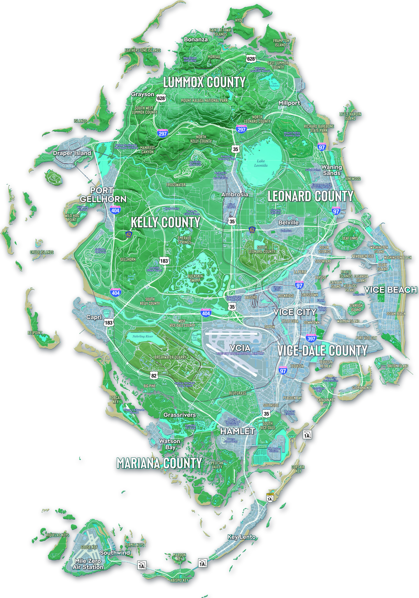
GTA 6's map of Leonida has about 31 square miles (81 km²) of land. Confirmed We measured it on Rockstar's official Map of Leonida, using the scale printed in the map's own legend: 1 inch = 0.5 mile. That makes Leonida roughly 1.6 times the size of GTA 5's map.
You can check every number below yourself on our interactive official map. Its Distance and Area tools use the same scale.
GTA 6 map size at a glance
| Measure | Figure | How we got it |
|---|---|---|
| Land area | ≈ 31 sq mi (81 km²) | Land pixels on the official map, at its printed scale |
| Land plus inland water | ≈ 36 sq mi (94 km²) | Including lakes, swamps and rivers |
| Land, east to west | ≈ 7.6 mi (12.3 km) | Widest point, including outer islands |
| Land, north to south | ≈ 10.9 mi (17.6 km) | Hyde Island to the southern keys |
| Map sheet | 9.0 × 12.5 mi | The printed frame |
| Grid squares | 1 × 1 mile | Rows A–M, columns 1–9 |
| Compared with GTA 5 | ≈ 1.6× the land | Against GTA 5's ≈ 49.7 km² |
Reported Our figure lines up with an independent estimate: GTADB measures GTA 6's land at about 82.7 km² against GTA 5's 49.7 km². Two different methods landing within 2% of each other is a good sign the scale is right.
How we measured it
- The scale. Confirmed The legend on the official map says 1 inch = 0.5 mile / 2 inches = 1 mile. The full-resolution map is 300 dpi, so 600 pixels equal 1 mile. The scale bar measures 601 pixels per mile, and the printed grid squares are exactly 600 pixels, so all three agree.
- The land. We separated land from sea by colour, then removed the legend, compass, seal and the place names printed on the water. Inland lakes count as water.
- The area. We counted the land pixels and converted them with the scale: 600 × 600 pixels = 1 square mile.
The printed scale is Rockstar's, but game maps aren't always drawn exactly to scale, so treat these as close estimates rather than in-game measurements.
How far apart are the main places?
Straight-line distances, label to label on the official map. Click any name to open it on the interactive map, where the detail panel lists its nearest neighbours.
| From | To | Distance |
|---|---|---|
| Bonanza (far north) | Key Lento | 9.1 mi (14.7 km) |
| Port Gellhorn | Vice Beach | 5.6 mi (8.9 km) |
| Bonanza | Vice City | 5.3 mi (8.5 km) |
| Vice City | Port Gellhorn | 4.1 mi (6.6 km) |
| Vice City | Key Lento | 4.2 mi (6.8 km) |
| Vice City | Millport | 3.8 mi (6.1 km) |
| Vice City | Capri | 3.7 mi (5.9 km) |
| Key Lento | Mile Zero Air Station | 2.9 mi (4.6 km) |
| Vice City | Grassrivers | 2.8 mi (4.6 km) |
| Vice City | Ambrosia | 2.4 mi (3.9 km) |
| Vice City | Hamlet | 2.4 mi (3.9 km) |
Roads wind, so driving distances will be longer than these.
Where the size comes from
Most of the land is the main peninsula, from Mount Kalaga National Park in the north down to Grassrivers and Mariana County. On top of that:
- Vice City and Vice Beach fill the east coast, with a bay of islands between them. See the five counties for how the state is divided.
- The Leonida Keys curve south-west along State Route 1A to Mile Zero Air Station.
- Barrier islands and sandbars ring the west and north coasts.
For what each area is modelled on, see GTA 6 map vs real Florida. For the road network, see every GTA 6 highway.
Measure it yourself
Open the interactive GTA 6 map, choose Area, and click around any island or town to get its size in square miles or km². Choose Distance to measure a route. The map also shows the 1-mile grid square under your cursor, and you can switch between the floating land and the full printed poster.
Frequently Asked Questions
How big is the GTA 6 map?
About 31 square miles (81 km²) of land, measured on Rockstar's official Map of Leonida with the scale printed on it. Counting inland lakes, swamps and rivers it's about 36 square miles. The land stretches about 7.6 miles east to west and 10.9 miles north to south.
Is the GTA 6 map bigger than GTA 5?
Yes. GTA 5's land is usually measured at about 49.7 km², so Leonida's roughly 81 km² is about 1.6 times bigger.
How long does it take to cross the GTA 6 map?
We can't time it from a map. In a straight line, Bonanza in the far north to Key Lento in the south is about 9.1 miles (14.7 km), and Port Gellhorn on the west coast to Vice Beach is about 5.6 miles (8.9 km).
How accurate is the GTA 6 map scale?
It's the scale Rockstar printed on the map (1 inch = 0.5 mile), and the map's grid squares match it exactly at 1 mile each. Game worlds don't always match their printed maps, so treat distances as close estimates.
Sources
Hub of GTA covers GTA 6 as an independent fan resource. Not affiliated with Rockstar Games or Take-Two Interactive.