GTA 6 Vice City Map: All 17 Neighbourhoods on the Official Map
Hub of GTA Editorial Team
Editorial · Hub of GTA
Confirmed official Rockstar, Take-Two or platform source. Reported a named outlet, not confirmed by Rockstar. Rumour unverified, treat with caution.
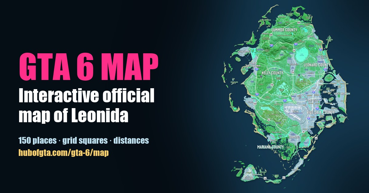
Rockstar's official Map of Leonida names 17 neighbourhoods in and around Vice City. Confirmed They are Downtown, Little Cuba, Flam, Crosstown, Rockridge, Salton, Balsero, Bayside, La Perle, Stockyard, Decor District, Tequesta, Tequesta Retreat, Peacock Bay, Port Vice City, and, on Vice Beach across the bay, Ocean Beach and Washington Beach. All 17 are printed on the free official map, and every one opens on our interactive GTA 6 map.
The map prints names but no city limits or district borders. So "where" below means where Rockstar printed each name, measured from the Downtown label with the map's own scale (1 inch = 0.5 mile).
Every Vice City neighbourhood at a glance
| Neighbourhood | Grid | From Downtown | Next to |
|---|---|---|---|
| Downtown | G7 | 0 | Little Cuba, Flam |
| Little Cuba | G7 | 0.4 mi west | Salton, Downtown |
| Flam | G7 | 0.4 mi north | Crosstown, Bayside |
| Crosstown | G7 | 0.5 mi north | Flam, Bayside |
| Rockridge | G6 | 0.7 mi north-west | Crosstown, Little Cuba |
| Salton | H6 | 0.8 mi west | Little Cuba, Balsero |
| Tequesta | H7 | 0.8 mi south | Tequesta Retreat, Peacock Bay |
| Tequesta Retreat | H7 | 0.8 mi south | Tequesta, Downtown |
| Bayside | G7 | 0.8 mi north | Stockyard, Crosstown |
| La Perle | G7 | 1.0 mi north | Bayside, Crosstown |
| Port Vice City | H8 | 1.0 mi east | Ocean Beach, Tequesta Retreat |
| Stockyard | F7 | 1.1 mi north | Decor District, Bayside |
| Balsero | G6 | 1.2 mi north-west | Salton, Rockridge |
| Decor District | F7 | 1.4 mi north | Stockyard, Bayside |
| Peacock Bay | I7 | 1.4 mi south | Tequesta, Tequesta Retreat |
| Ocean Beach | G8 | 1.5 mi east | Port Vice City, Washington Beach |
| Washington Beach | F9 | 2.0 mi north-east | Ocean Beach, Decor District |
Distances are straight lines between the printed labels. Grid squares are the map's own 1-mile grid (rows A to M, columns 1 to 9).
The city centre: Downtown, Little Cuba, Flam and Crosstown
The core of the city sits in grid square G7. Confirmed Downtown is printed beside the bay with Little Cuba just west of it, and Flam and Crosstown just north. Interstate 397's only sign on the map is beside Downtown, and Interstate 97 runs north–south through Crosstown. The Sahara Arena is printed on the bayfront between Flam and Downtown.
The north side: Bayside, La Perle, Stockyard and Decor District
North of the centre, Bayside and La Perle face the bay islands, with Stockyard and the Decor District further up, in grid square F7.
The west side: Rockridge, Salton and Balsero
Rockridge, Salton and Balsero fill the west of the city. Confirmed Fleeca Field is printed beside Rockridge, the Tisha-Wocka Flea Market beside Balsero, and Vice City International Airport (VCIA) south-west of Salton.
The south side: Tequesta, Tequesta Retreat and Peacock Bay
Tequesta and Tequesta Retreat sit just south of Downtown in H7, with Peacock Bay beyond them. Confirmed The Vice City Oceanarium and Courtland Park are printed next to Tequesta Retreat.
Across the water: Port Vice City and Vice Beach
Port Vice City is printed on its own island east of Downtown. Further east, Vice Beach is the long barrier island with Ocean Beach and Washington Beach along its shore. Between them sit more than a dozen bay islands, including Starfish Island; see every island on the GTA 6 map.
Names that return from GTA Vice City (2002)
Confirmed Five names on the GTA 6 map were also places in 2002's GTA Vice City: Downtown, Ocean Beach and Washington Beach, plus the islands Starfish Island and Leaf Links. Other 2002 names, like Little Havana and Vice Point, aren't on the new map. Little Cuba takes a similar spot next to Downtown, which reads to us as a nod to Little Havana (our read; Rockstar hasn't said).
For the real-world parallels, see GTA 6 map vs real Florida. For the county the city sits in, see the five counties of Leonida.
Explore Vice City yourself
Open the interactive map, switch on Layers → Neighbourhoods, and click any name for its grid square, distances and nearest places. The map directory lists the city's venues, airports and more by type.
Frequently Asked Questions
How many neighbourhoods does Vice City have in GTA 6?
Rockstar's official Map of Leonida prints 17 neighbourhood names in and around Vice City: Downtown, Little Cuba, Flam, Crosstown, Rockridge, Salton, Balsero, Bayside, La Perle, Stockyard, Decor District, Tequesta, Tequesta Retreat, Peacock Bay, Port Vice City, Ocean Beach and Washington Beach.
Which GTA Vice City districts return in GTA 6?
Downtown, Ocean Beach and Washington Beach are printed on the GTA 6 map, as are the islands Starfish Island and Leaf Links. All five names were in GTA Vice City (2002).
Where is Vice Beach in GTA 6?
Vice Beach is the barrier island east of Vice City, across the bay. Ocean Beach and Washington Beach are printed along it.
Does the GTA 6 map show where Vice City ends?
No. The official map prints neighbourhood names but no city limits or district borders, so which streets belong to which neighbourhood isn't shown.
What is Little Cuba based on?
Rockstar hasn't said. Our read is Miami's Little Havana, since Little Cuba sits right next to Downtown the way Little Havana sits next to downtown Miami.
Sources
Hub of GTA covers GTA 6 as an independent fan resource. Not affiliated with Rockstar Games or Take-Two Interactive.