GTA 6 Water Map: Every Lake, River and Bay in Leonida
Hub of GTA Editorial Team
Editorial · Hub of GTA
Confirmed official Rockstar, Take-Two or platform source. Reported a named outlet, not confirmed by Rockstar. Rumour unverified, treat with caution.
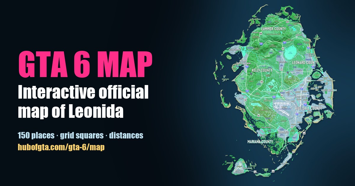
Rockstar's official Map of Leonida names 27 bodies of water. Confirmed There are 5 lakes, 4 rivers and a creek, 10 bays, 2 sounds, a bight, a basin, and the open sea around the state: the Atlantic Ocean to the east, the Gulf of Leonida to the west and the Leonida Straits to the south. The biggest inland water is Lake Leonida, in the middle of the state.
Every name below is printed on the free official map and opens on our interactive GTA 6 map. "Nearest town" is measured label to label with the map's own scale.
Lakes (5)
| Lake | Grid | Where |
|---|---|---|
| Lake Leonida | E6 | Centre of the state, 0.7 mi north-east of Ambrosia |
| Lake Tallaloko | C6 | Lummox County, 0.4 mi north-west of Millport |
| Tortoise Lake | G3 | West coast, 0.3 mi east of Capri |
| Three Toe Lake | H5 | 1.4 mi north of Grassrivers |
| Cottonmouth Lake | K5 | The south, 1.1 mi north-west of Key Lento |
Reported Lake Leonida is widely compared to Lake Okeechobee, Florida's huge round lake, for example by allthings.how. Confirmed The town of Ambrosia and the Allied Crystal sugar refinery sit on its south-west side. Lake Tallaloko has the Tallaloko Lakeside Resort printed beside it.
Rivers and creeks (5)
| River | Grid | Nearest town |
|---|---|---|
| Moreau River | B6 | Bonanza (0.8 mi) |
| Emerald River | F5 | Ambrosia (1.5 mi) |
| Nehrling River | H4 | Capri (1.0 mi) |
| Pelican River | J5 | Watson Bay (0.4 mi) |
| Burial Creek | G4 | Capri (1.0 mi) |
The Pelican River runs through the Grassrivers wetlands in the south, and the Moreau River through the hill country of Lummox County in the north.
Bays, sounds and basins (14)
| Water | Grid | Coast | Nearest town |
|---|---|---|---|
| Okchiloha Bay | B4 | North | Bonanza |
| Partridge Bay | B6 | North | Bonanza |
| San Malo Bay | C3 | North-west | Grayson |
| Millport Basin | C7 | North-east | Millport |
| Draper Bay | E3 | West | Port Gellhorn |
| Borrachero Sound | F2 | West | Port Gellhorn |
| Capri Sound | G2 | West | Capri |
| Bobcat Bight | H3 | West | Capri |
| Tola Bay | I4 | South-west | Grassrivers |
| Leonida Bay | J4 | South | Watson Bay |
| Wetman Bay | J5 | South | Watson Bay |
| Peregrine Bay | J6 | South | Hamlet |
| Gambit Bay | K6 | South | Key Lento |
| Catalan Bay | H8 | East | Vice Beach |
Draper Bay separates Port Gellhorn from Draper Island. Catalan Bay is the water south of Vice City's bay islands; see every island in GTA 6.
The open sea (3)
- Atlantic Ocean, off the east coast beyond Vice Beach and Waning Sands.
- Gulf of Leonida, off the west coast, Leonida's version of the Gulf of Mexico (our read).
- Leonida Straits, south of the Leonida Keys.
How much of Leonida is water?
Confirmed Measured on the official map with its printed scale, Leonida has about 31 sq mi of dry land and about 36 sq mi once its lakes, swamps and rivers are counted, so roughly 5 sq mi of inland water. The full method is in how big the GTA 6 map is.
Explore the water
On the interactive map, open Layers and switch on Bays, lakes & rivers, or search any name. The map directory also lists the parks and swamps, such as Buckskin Swamp.
Frequently Asked Questions
What is the biggest lake in GTA 6?
Lake Leonida, the large round lake in the middle of the state, beside Ambrosia in Leonard County. It's often compared to Florida's Lake Okeechobee.
How many lakes are in GTA 6?
The official map names five: Lake Leonida, Lake Tallaloko, Tortoise Lake, Three Toe Lake and Cottonmouth Lake. It also shows many smaller unnamed lakes and swamp pools.
What rivers are in GTA 6?
The official map names the Moreau, Emerald, Nehrling and Pelican rivers, plus Burial Creek.
What sea is around Leonida?
The map labels the Atlantic Ocean off the east coast, the Gulf of Leonida off the west coast and the Leonida Straits to the south.
Sources
Hub of GTA covers GTA 6 as an independent fan resource. Not affiliated with Rockstar Games or Take-Two Interactive.